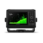
Garmin GPSMAP® 1022xsv chartplotter with sonar

Details
SONAR CAPABLE
Chartplotters include built-in single-channel CHIRP sonar plus CHIRP ClearVü™ and CHIRP SideVü™ scan sonars with Panoptix™ and LiveScope™ sonar support on select models (transducers sold separately).
BUILT-IN ANT® CONNECTIVITY
Take advantage of built-in ANT wireless connectivity on your compatible Garmin devices, such as quatix® watersports watches, gWind™ Wireless 2 transducers, GNX™ Wind watersports instruments and wireless remotes.
CONNECTED ACTIVECAPTAIN® APP
Built-in Wi-Fi® technology gives you access to the free all-in-one ActiveCaptain app. This puts you in control of your watersports experience almost anywhere from your compatible smartphone.
Easy navigation.
GARMIN SAILASSIST™ FEATURE.
Use the polar table to view important data fields. This will help you prepare your boat for sailing and achieve maximum speed and efficiency. You can also view ley lines, course deviation and true and apparent wind data (sensor sold separately), among other things.
MAPS
Give your chartplotter a new look with optional Garmin Navionics+™ or premium Garmin Navionics Vision+™ charts for inland/coastal water information, access to daily updates, Auto Guidance+™ technology1 and more.
HASSLE-FREE TRACKING
The built-in, fast, sensitive 10 Hz GPS and GLONASS receiver refreshes your position and heading 10 times per second so your movement is more fluidly displayed on the screen.
NETWORK FUNCTIONALITY
The GPSMAP chartplotters feature full network functionality for the Garmin Marine Network and NMEA 2000® networks, plus support for NMEA 0183 technology.
TRANSFER OF GPX WAYPOINTS
Easily transfer waypoints, tracks or frequently used routes from other devices via the standard GPX file format.
SHARING VIA NETWORK
Garmin Marine Network support lets you share sonar, maps, user data, dome or open-array radars, and Panoptix and LiceScope sonars with multiple devices.
CONNECTION TO THE ENGINE
Read rpm, fuel flow, temperature, trim and other important information at a glance. Contact your engine manufacturer for any additional materials you may need.
SEND MESSAGES WITH YOUR INREACH® DEVICE
Pair the inReach satellite communicator2 with your chartplotter and type custom messages using the MFD on-screen keyboard. Open your contact list or enter an email address, inReach address or phone number. You can also group messages by call, just like in a text message.
POWER-POLE® SHALLOW-WATER ANCHOR.
By connecting certain Garmin chartplotters via network to a Force® trolling motor and your compatible Power-Pole shallow-water anchor system, you can access advanced boating control features3 from your plotter, including Smart Anchor automatic anchor throw and retrieve, automatic stow, anchor drag detection and Auto Guidance1 anchoring at end of route. Spend more time fishing, less time positioning.
CHARGE INTEGRATION OF POWER-POLE
Power-Pole's CHARGE Marine Power Manager integrates with compatible Garmin chartplotters to increase your battery power on the water and last longer. You can recharge batteries on the go, monitor power consumption, select where power goes, control emergency starts and even transfer power between power banks. All from the screen of your chartplotter.
More Information
| Supplier ref | 010-01740-02 |
|---|---|
| Manufacturer ref | 010-01740-02 |
| EAN code manufacturer | 0753759168315 |
| Brand | Garmin |
| Product weight (kg) | 1.8500 |
| Dimensions | 31.8 x 18.5 x 6.9 cm |
| Max current | 35615 |
| Waterproof rating | IPX7 |
| Display resolution | 1024 x 600 |
| Display size | 35600 |
| Sonar technology | CHIRP, ClearVü, SideVü |
| Network connections | Bluetooth, Wi-Fi, NMEA 2000 |
| Input voltage | 10-32 VDC |
| Power consumption | 35831 |
| Transducer | None |
| Integrated GPS | Yes |
-

-

-
 Garmin ECHOMAP™ UHD2 5" chartplotter with GT20-TM transducerSpecial Price €380.24 Regular Price €449.99
 -

