Nautical charts
Detailed maps specially designed for navigation at sea. They show water depths, coastlines, buoys, beacons, and other important information for safe navigation.
Explore a comprehensive collection of charts and maps to navigate the seas with precision and safety. Whether you're a seasoned sailor or a novice boater, discover detailed nautical charts tailored to your region, providing essential information on depths, currents, landmarks, and navigation aids. From the coasts to offshore passages, find the right chart to plan your voyages and explore the waters with confidence
Shop By
 NV Atlas France FR1 - Oostende à CherbourgSpecial Price €60.30 Regular Price €64.38
 NV Atlas France FR2 - Cherbourg à St. MaloSpecial Price €63.60 Regular Price €64.38
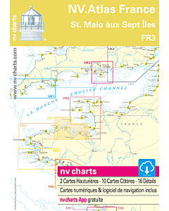 NV Atlas France FR3 - St. Malo aux Sept ÎlesSpecial Price €63.60 Regular Price €64.38
 NV Atlas France FR4 - Les Sept Isles à DouarnenezSpecial Price €63.60 Regular Price €64.38
 NV Atlas France FR5 - Douarnenez à LorientSpecial Price €63.60 Regular Price €64.38
 NV Atlas France FR6 - Lorient à Île de Noirmoutier - NantesSpecial Price €63.60 Regular Price €64.38
 NV Atlas France FR7 - Îles de Noirmoutier à Oléron - La RochelleSpecial Price €63.60 Regular Price €64.38
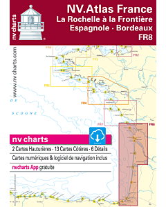 NV Atlas France FR8 - Île d'Oléron à San Sebastian - BordeauxSpecial Price €63.60 Regular Price €64.38
 NV Atlas France FR9 - Cabo Creus to ToulonSpecial Price €63.60 Regular Price €64.38
