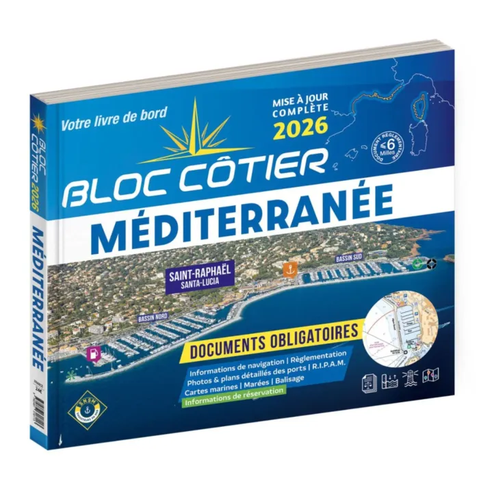
Bloc Côtier Méditerranée 2026
Details
Language: French with English short texts.
The NV Charts Bloc Côtier Méditerranée is a compact version of the well-known Bloc Marine guide, offering essential maritime information in an easy-to-carry format. The guide is updated annually to ensure reliable and current navigation data.
The guide covers the entire French Mediterranean coastline, as well as additional sailing regions including Corsica, Sardinia, the Balearic Islands and the coast of Tunisia. Harbour descriptions are complemented by detailed approach information and aerial photographs to help skippers safely enter ports and marinas.
In addition to navigation charts, the guide contains tide tables, current information, meteorological explanations and safety advice, making it a valuable onboard reference for coastal cruising and trip preparation.
Key features
-
Compact Mediterranean cruising guide
-
Detailed harbour plans and coastal charts
-
Coverage: French Mediterranean coast, Corsica, Sardinia, Balearic Islands and Tunisia
-
Includes tide tables and current information
-
Meteorological explanations and maritime safety advice
-
Updated annually for accurate navigation data
More Information
| Area | Mediterranean |
|---|---|
| Manufacturer ref | 32400 |
| Brand | Bloc Côtier |
| Medium | Paper |