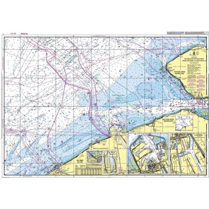
Admirality North Sea. Belgium and Netherlands. From Oostende to Westkapelle
Official Admiralty nautical chart BE0101 covering the Belgian and Dutch coastline from Oostende to Westkapelle. Includes detailed plans of Brugge, Zeebrugge Inner Harbour, Zeebrugge Outer Harbour and Blankenberge. Printed on demand with the latest chart corrections applied.
Ref Seashop
BE0101
Manufacturer ref
BE0101
€74.03
Details
Admiralty Chart BE0101 covers the coastal waters between Oostende and Westkapelle and forms part of the International Chart Series (INT 1474). It provides essential navigational information for commercial shipping, recreational boating and professional mariners.
The chart includes a main coastal chart together with detailed harbour plans of:
- Brugge
- Zeebrugge Inner Harbour (Achterhaven)
- Zeebrugge Outer Harbour (Voorhaven)
- Blankenberge
Features
- Official Admiralty / UK Hydrographic Office nautical chart
- Coverage: Oostende to Westkapelle
- International Chart Series INT 1474
- Main scale: 1:60,000
- Detailed harbour plans included
- Printed on demand with the latest corrections applied
- Suitable for passage planning, coastal navigation and harbour approaches
An essential navigation chart for sailors and mariners operating along the Belgian coast, the approaches to Zeebrugge and the Western Scheldt area.
More Information
| Area | Belgium |
|---|---|
| Supplier ref | BA BE0101 |
| Manufacturer ref | BE0101 |
| Brand | Admiralty |
| Medium | Paper |
| Product weight (kg) | 0.3000 |