NV Charts Pilot 2 North Sea
Détails
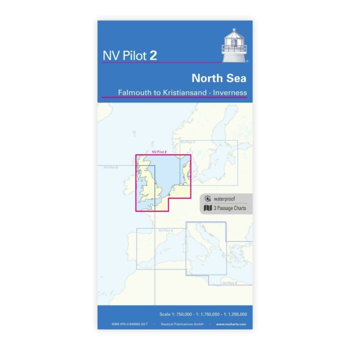
The Pilot 2 from NV Charts is the planning chart that is needed for the North Sea. The west coast of Denmark, the German North Sea and the coast of the Netherlands are covered in this oversailor. The area around the English Channel and the east coast of Great Britain can also be found here.
This folding chart consists of three overview charts:
Chart 1, scale 1: 750,000> the southwestern North Sea and German Bight from Dover to Helgoland and Doggerbank in the north
Chart 2, scale 1: 750,000> English Channel from Falmouth / Ushant to Dover in scale
Chart 3, scale: 1: 1,255,000> North Sea from Great Yarmouth to Skagen, Inverness and the south coast of Norway.
The beacons, oil drilling platforms, traffic separation areas and wind farms that are important for planning the passage are shown on all three charts. The terms are in English. The chart is in A1 format, folded approx. 15 x 30 cm.
Plus d'infos
| Région | Mer du nord |
|---|---|
| Référence fournisseur | pilot 2 |
| Référence fabricant | pilot 2 |
| Code bar contructeur | 9783910644847 |
| Marque | NV Charts |
| Poids produit (kg) | 0.1000 |
-

-

-
 Imray A281 Anchorages in Guadeloupe, Les Saintes and Marie-GalantePrix spécial 29,57 € Prix normal 31,10 €
 -
 Imray 2500 The Channel Islands and adjacent coast of FrancePrix spécial 81,62 € Prix normal 84,56 €
