Nautical charts
Detailed maps specially designed for navigation at sea. They show water depths, coastlines, buoys, beacons, and other important information for safe navigation.
Explore a comprehensive collection of charts and maps to navigate the seas with precision and safety. Whether you're a seasoned sailor or a novice boater, discover detailed nautical charts tailored to your region, providing essential information on depths, currents, landmarks, and navigation aids. From the coasts to offshore passages, find the right chart to plan your voyages and explore the waters with confidence
Shop By
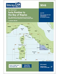 Imray M46 Isole Pontine to the Bay of NaplesSpecial Price €29.57 Regular Price €31.10
 Imray M45 Tuscan ArchipelagoSpecial Price €29.57 Regular Price €31.10
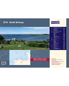 Imray 2510 NORTH BRITTANYSpecial Price €81.62 Regular Price €84.56
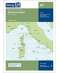 Imray M7 Bonifacio StraitSpecial Price €29.57 Regular Price €31.10
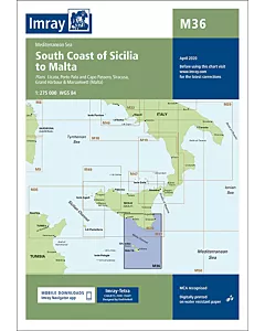 Imray M36 South Coast of Sicilia to MaltaSpecial Price €29.57 Regular Price €31.10
 Imray C43 Santander to A CoruñaSpecial Price €34.98 Regular Price €37.63
 Imray Chart 100 North Atlantic Ocean Passage ChartSpecial Price €34.98 Regular Price €37.63
 Imray E5 BermudaSpecial Price €29.57 Regular Price €31.09
 NV Charts Baltic Sea Box Region 1-4Special Price €245.92 Regular Price €246.67
