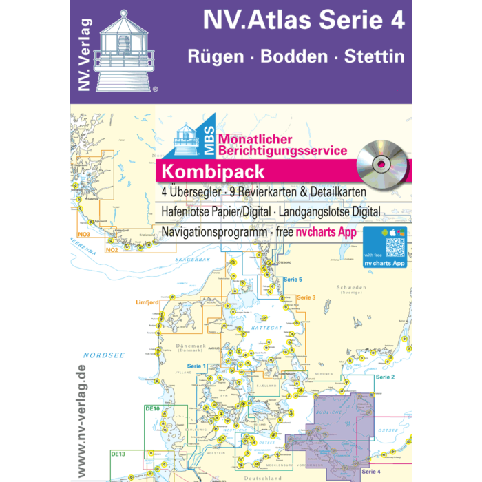
NV Atlas Serie 4 Ruggen - Bodden - Stettin
Ref Seashop
7011704
Barcode manufacturer
9783932414954
Speciale prijs € 74,20 Normale prijs € 74,28
Gegevens
NV.Atlas Serie 4 Ruggen - Bodden - Stettin
Format: Kombipack Papier / Digital download and App
Overview charts
Übersichtskarte Serie 4 1 :370.000
S 25 Bornholm 1 :140.000
S 45 Hiddensee bis Swinemünde 1 :240.000
S 46 Rügen bis Bornholm 1 :240.000
Coastal charts
S 36 Die Bodden südl. Zingst 1 : 60.000
S 37 Strelasund Nord 1 : 60.000
S 38 Hiddensee bis Jasmund 1 : 60.000
S 39 Strelasund Süd 1 : 40.000
S 40 Greifswalder Bodden West 1 : 60.000
S 41 Greifswalder Bodden Ost 1 : 60.000
S 42 Peenestrom Süd 1 : 60.000
S 43 Stettiner Haff 1 : 80.000
S 45A Arkona bis Landtief 1 :100.000
Details
S 39A Stralsund 1 : 40.000
S 41A Ruden bis Wolgast 1 : 40.000
S 43A Dievenow (Dziwna) 1 : 30.000
S 44 Die Oder bis Stettin-Nord 1 : 30.000
S 44A Die Oder bis Stettin-Süd 1 : 30.000
Since decades nv charts / NV Verlag are developing nautical charts cartography in the Baltic Sea, North Sea, Kattegat, Skagerak and the Norwegian south coast. With an keen eye on details and precise local knowledge every nautical charts is designed of the best available data. In many cases with own detailed survey data, also outside the main fairways. NV Charts nautical charts are thoroughly corrected and are easy to read. NV Charts nautical charts are remarkably detailed nautical charts of high quality in paper, digital electronic nautical charts on pc / tablet andoid apple ios (with free app), digital plotter SD/microSD cards. Therefore our nautical charts are also the choice of professionals like the US Coastguard.
Passage Charts
Coastal Charts
Details
monthly correction service with email
Digital charts and software
Currents
Tides
Harbour Plans paper & digital
The nv charts are characterized by fine contours and easy to distinguish color graduations of the depth lines. The importance of good graphical representation of the topography when sailing is essential. Well marked rivers, towns and street plans all help to give a clear overall view of the shore side facilities of the islands. In waters soundings and heights are given in meters. Large scale approaches and land contour markings simplify the entrance into anchorages.
Meer informatie
| Gebied | Ostsee |
|---|---|
| Leverancier ref | 1704 |
| Barcode manufacturer | 9783932414954 |
| Merk | NV Charts |
| Medium | paper |
| products size | 1.0000 |
| Gewicht produkt | 2.0000 |
| Uitgever | nv |
Gerelateerde producten
-
-
-
 Hydrografische kaart 1812 Waddenzee oostblad en aangrenzende NoordzeekustSpeciale prijs € 33,92 Normale prijs € 33,99
 -
 NV Atlas Norway NO6 - Sørvestlandet Norge - Stavanger til HaugesundSpeciale prijs € 74,20 Normale prijs € 74,28