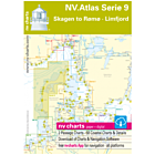
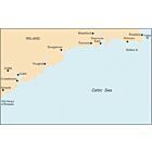
NV Atlas SE 5.1 Sverige Svenska vastkusten norra
Ref Seashop
7011751
Barcode manufacturer
9783945902042
Speciale prijs € 68,90 Normale prijs € 69,25
Gegevens
NV.Atlas Sverige SE 5.1 Svenska västkusten norra
Format: Kombipack Papier / Digital download and App
Übersegler
S1 Halden to Lysekil 1: 240.000
S2 Lysekil to Varberg 1: 240.000
Pilot Chart Anholt-Færder-Jomfruland 1: 750.000
Revierkarten
S3 Krokstrand to Svinesund 1: 40.000
S3A Åbyfjorden to Brofjorden 1: 40.000
S4 Svinesund to Dynekilen 1: 40.000
S5 Dynekilen to Koster Fjord 1: 40.000
S6 Koster Fjord to Havstenssund 1: 40.000
S7 Havstenssund to Bramskär 1: 40.000
S8 Bramskär to Hamburgsund 1: 40.000
S9 Hamburgsund to Smögen 1: 40.000
S10 Smögen to Fiskebäckskil 1: 40.000
S11 Gullmarn Fjord 1: 40.000
Detailkarten
S12 Koster Skärgården 1: 20.000
S13 Grebbestad to Fjällbacka 1: 20.000
S14 Fjällbacka to Dannemark 1: 20.000
S15 Dannemark to Sotekanal 1: 20.000
S16 Smögen to Malmön 1: 20.000
S17 Malmön to Lysekil 1: 20.000
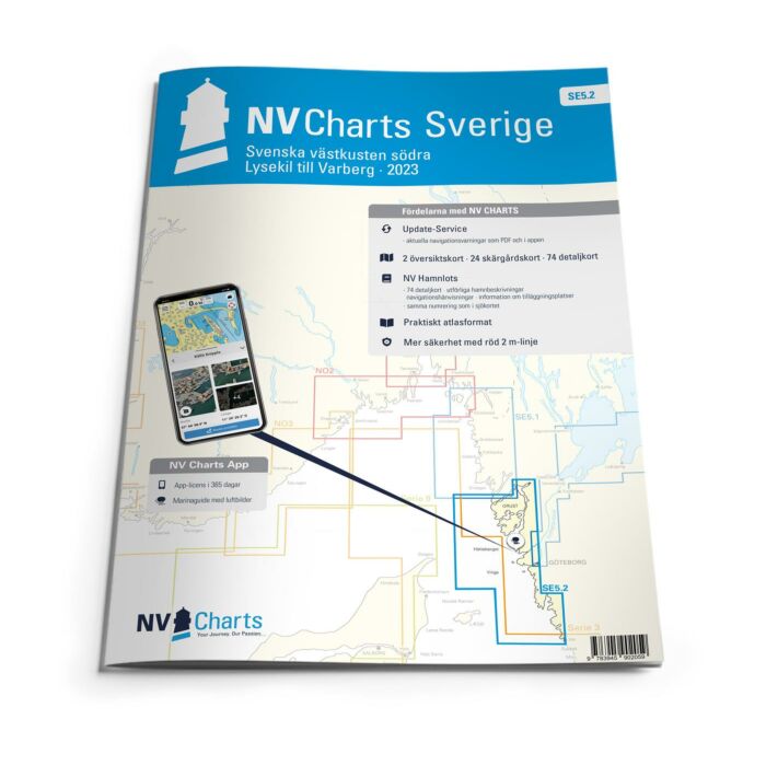
Since decades nv charts / NV Verlag are developing nautical charts cartography in the Baltic Sea, North Sea, Kattegat, Skagerak and the Norwegian south coast. With an keen eye on details and precise local knowledge every nautical charts is designed of the best available data. In many cases with own detailed survey data, also outside the main fairways. NV Charts nautical charts are thoroughly corrected and are easy to read. NV Charts nautical charts are remarkably detailed nautical charts of high quality in paper, digital electronic nautical charts on pc / tablet andoid apple ios (with free app), digital plotter SD/microSD cards. Therefore our nautical charts are also the choice of professionals like the US Coastguard.
Passage Charts
Coastal Charts
Details
monthly correction service with email
Digital charts and software
Currents
Tides
Harbour Plans paper & digital
The nv charts are characterized by fine contours and easy to distinguish color graduations of the depth lines. The importance of good graphical representation of the topography when sailing is essential. Well marked rivers, towns and street plans all help to give a clear overall view of the shore side facilities of the islands. In waters soundings and heights are given in meters. Large scale approaches and land contour markings simplify the entrance into anchorages.
Format: Kombipack Papier / Digital download and App
Übersegler
S1 Halden to Lysekil 1: 240.000
S2 Lysekil to Varberg 1: 240.000
Pilot Chart Anholt-Færder-Jomfruland 1: 750.000
Revierkarten
S3 Krokstrand to Svinesund 1: 40.000
S3A Åbyfjorden to Brofjorden 1: 40.000
S4 Svinesund to Dynekilen 1: 40.000
S5 Dynekilen to Koster Fjord 1: 40.000
S6 Koster Fjord to Havstenssund 1: 40.000
S7 Havstenssund to Bramskär 1: 40.000
S8 Bramskär to Hamburgsund 1: 40.000
S9 Hamburgsund to Smögen 1: 40.000
S10 Smögen to Fiskebäckskil 1: 40.000
S11 Gullmarn Fjord 1: 40.000
Detailkarten
S12 Koster Skärgården 1: 20.000
S13 Grebbestad to Fjällbacka 1: 20.000
S14 Fjällbacka to Dannemark 1: 20.000
S15 Dannemark to Sotekanal 1: 20.000
S16 Smögen to Malmön 1: 20.000
S17 Malmön to Lysekil 1: 20.000
Since decades nv charts / NV Verlag are developing nautical charts cartography in the Baltic Sea, North Sea, Kattegat, Skagerak and the Norwegian south coast. With an keen eye on details and precise local knowledge every nautical charts is designed of the best available data. In many cases with own detailed survey data, also outside the main fairways. NV Charts nautical charts are thoroughly corrected and are easy to read. NV Charts nautical charts are remarkably detailed nautical charts of high quality in paper, digital electronic nautical charts on pc / tablet andoid apple ios (with free app), digital plotter SD/microSD cards. Therefore our nautical charts are also the choice of professionals like the US Coastguard.
Passage Charts
Coastal Charts
Details
monthly correction service with email
Digital charts and software
Currents
Tides
Harbour Plans paper & digital
The nv charts are characterized by fine contours and easy to distinguish color graduations of the depth lines. The importance of good graphical representation of the topography when sailing is essential. Well marked rivers, towns and street plans all help to give a clear overall view of the shore side facilities of the islands. In waters soundings and heights are given in meters. Large scale approaches and land contour markings simplify the entrance into anchorages.
Meer informatie
| Gebied | Zweden |
|---|---|
| Leverancier ref | 1751 |
| Barcode manufacturer | 9783945902042 |
| Merk | NV Charts |
| Medium | paper |
| products size | 1.0000 |
| Gewicht produkt | 2.0000 |
| Uitgever | nv |
Gerelateerde producten