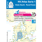
NV Atlas Baltic Serie 3 - Samsø - Sund - Kattegat
Details
NV.Atlas Baltic Serie 3 - Samsø - Sund - Kattegat
Format: Kombipack Papier / Digital download and App
Passage charts
Übersichtskarte Serie 3 1 : 520,000
Skagerrak 1 : 520,000
S30 Kattegat Süd 1 : 200,000
S31 Kattegat Mitte 1 : 200,000
S32 Kattegat Nord 1 : 180,000
District maps
S26 Sund Nord 1 : 80,000
S27 Isefjord 1 : 65,000
S27A Roskilde Fjord Nord 1 : 42,000
S27B Roskilde Fjord Süd 1 : 42,000
S28 Samsø Belt 1 : 108,000
S29 Aarhus Bucht 1 : 100,000
S34 Randers & Mariager Fjord 1 : 56,000
S35 Nordansteuerung Sund 1 : 65,000
Detailed maps
S26 Helsingør 1 : 25,000
S27B Gershøj Selsø Approach 1 : 25,000
S33 Ansteuerung Frederikshavn 1 : 40,000
S33 Frederikshavn 1 : 20,000
S33 Hals Approach 1 : 45,000
S34 Udbyhøj 1 : 18,000
S34 Hadsund Brücke 1 : 16,000
S35 Hallands Väderö 1 : 40,000
Product information "NV Charts Baltic Region 3 - Samsø - Sund - Kattegat"
The handy pleasure craft charts for the sea area Samsø - Sund - Kattegat are a chart series specially designed for recreational boating. It contains the nautical charts in various sizes, as well as all harbour plans and details for approaches and passages in the waters. In addition, there are also passageways for bridges, power lines, etc., as well as all nautical and navigation information. Thanks to the clear layout, the recreational skipper can quickly find approaches, harbours and anchorages and is made aware of navigationally important details that also appear in the NV Charts app. The chart series impresses with its optimal dimensions and balanced sheet sections.
Regions overview
As a continuation of the popular series 1 and 2, NV Charts offers the NV Charts Baltic Series 3 on. North of Copenhagen - where harbours and beautiful places are lined up and the distance between Denmark and Sweden is the shortest - this nautical chart set takes you along the Swedish west coast via Göteborg through the Kattegat to Skagen. You have the option of sailing via Aalborg Bay directly into the Limfjord towards the North Sea. Or simply visit the beautiful Kattegat islands of Läso, Anholt and Samsö.
As a supplement to this map set, we recommend the NV Charts Denmark Series 9 which guides you directly and safely through the Limfjord into the North Sea or the two Swedish chart sets NV Charts Sverige SE 5.2 and SE 5.1 which run along the entire Swedish west coast to the beginning of the Oslofjord.
This map set includes
- 7 passage charts
- 8 district maps
- 141 detailed maps
- Digital charts for navigation programme and NV Charts App 356-day licence
- New: vector map download
- Harbour pilot in paper / digital in German and English
- Shore leave pilot digital
- Aerial photographs of the German and Danish coasts digital
- Navigation instructions in German
- Fulfils the legal requirements for current paper charts on board recreational craft
More Information
| Area | Baltic |
|---|---|
| Supplier ref | 1703 |
| EAN code manufacturer | 9783910644021 |
| Brand | NV Charts |
| Medium | Paper |
| Product weight (kg) | 2.0000 |


