Nautical charts
Detailed maps specially designed for navigation at sea. They show water depths, coastlines, buoys, beacons, and other important information for safe navigation.
Explore a comprehensive collection of charts and maps to navigate the seas with precision and safety. Whether you're a seasoned sailor or a novice boater, discover detailed nautical charts tailored to your region, providing essential information on depths, currents, landmarks, and navigation aids. From the coasts to offshore passages, find the right chart to plan your voyages and explore the waters with confidence
Shop By
 Imray C25 Harwich to Humber and HollandSpecial Price €34.98 Regular Price €37.63
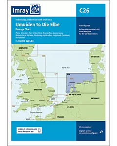 Imray C26 IJmuiden to Die ElbeSpecial Price €34.98 Regular Price €37.63
 Imray C30 Harwich to Hoek van Holland and Dover StraitSpecial Price €34.98 Regular Price €37.63
 Imray C70 Southern North SeaSpecial Price €34.98 Regular Price €37.63
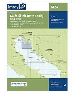 Imray M24 Golfo di Trieste to Lošinj & RabSpecial Price €29.57 Regular Price €31.10
 Imray M25 Otok Rab to SibenikSpecial Price €29.57 Regular Price €31.10
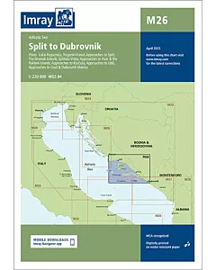 Imray M26 Split to DubrovnikSpecial Price €29.57 Regular Price €31.10
 Imray M27 Dubrovnik to Bar & UlcinjSpecial Price €29.57 Regular Price €31.10
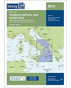 Imray M30 Southern Adriatic and Ionian SeasSpecial Price €29.57 Regular Price €31.10
 Imray 2120 North Sea - Nieuwpoort to Den HelderSpecial Price €81.62 Regular Price €84.56
 Imray M32 Adriatic Italy (South)Special Price €29.57 Regular Price €31.10
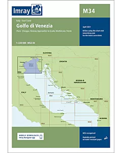 Imray M34 Golfo di VeneziaSpecial Price €29.57 Regular Price €31.10
 Imray 2140 GREVELINGENMEER AND MAAS DELTASpecial Price €81.62 Regular Price €84.56
 Imray 2160 IJSSELMEERSpecial Price €81.62 Regular Price €84.56
 Imray M23 Adriatic SeaSpecial Price €29.57 Regular Price €31.10
